Cart is empty
Cart is empty
View cart
Checkout
Account
View Previous Orders
Favorites
Sign in
Create an Account
Email
Password
Forgot password?
Create a new basic account
Sign in
Remember me
Cart is empty
Cart is empty
View cart
Checkout
Account
View Previous Orders
Favorites
Sign in
Create an Account
Email
Password
Forgot password?
Create a new basic account
Sign in
Remember me
Menu
NOAA Nautical Charts for U.S. Waters
8.5 x 11 BookletCharts
NOAA Atlantic Coast charts
NOAA Pacific Coast charts
NOAA Alaska Coast charts
NOAA Gulf Coast charts
NOAA Great Lakes charts
NOAA Training Charts
NOAA Custom Charts (NCC's)
Worldwide Nautical Charts
Canadian (CHS) Charts
NGA Charts: Region 1 - North America
NGA Charts: Region 2 - Central, South America
NGA Charts: Region 3 - UK, Western Europe
NGA Charts: Region 4 - Scandinavia, Northern Russia
NGA Charts: Region 5 - Western Africa, Mediterranean, Black Sea
NGA Charts: Region 6 - Eastern Africa, Southern & Western Asia
NGA Charts: Region 7 - South East Asia, Indonesia, New Guinea, Australia
NGA Charts: Region 8 - Pacific Islands
NGA Charts: Region 9 - Eastern Asia, South Eastern Russia, Philippines
NGA Charts: Miscellaneous
Nautical Publications
U.S. Chart No.1
USCG Navigation Rules Handbook
Nautical Almanac
U.S. Coast Pilot
USCG Light Lists
Tide and Tidal Current Tables
American Practical Navigator - Bowditch
Sight Reduction Tables
Code of Federal Regulations (CFR)
Atlas of Pilot Charts
NGA List of Lights
View more
→
Nautical Books
Chartbooks & Cruising Guides
Boating Skills & How-To
Boats
Other
Logbooks
Myerchin Rigging Knives
Professional
Mariner Training
Navigation Tools
Bestsellers in this Category
Cornell's Ocean Atlas 3rd Edition
CCA Essential Passage Guide to the Viking Route
Chesapeake Bay Chart Atlas (12x18 spiral-bound)
Great Lakes Chart Atlas (Lake Michigan & Lake Superior) 12x18 Spiral-bound
Florida Keys Chart Atlas (12x18 Spiral-bound)
World Cruising Destinations 3rd Edition
Southeast Atlantic Coast Chart Atlas (12x18 Spiral-bound)
Gulf Coast Texas to Mississippi Chart Atlas (12x18 Spiral-Bound)
Chartbooks & Cruising Guides
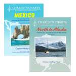
Charlie's Charts
Cruising Guide Publications
Evergreen Publishing
Imray Guides
Jimmy Cornell Books
Sea Trail Maps
Seaworthy Publications
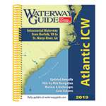
Waterway Guides
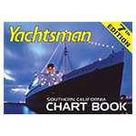
Yachtsman Chart Books
International Chartbooks & Cruising Guides
U.S. Region Cruising Guides
Sort by Bestselling
Newest Items First
Sort Alphabetically: A to Z
Sort Alphabetically: Z to A
Sort by Price: Low to High
Sort by Price: High to Low
24 Per Page
16 Per Page
32 Per Page
64 Per Page
128 Per Page
Jimmy Cornell 2-PACK (includes Destinations & Routes)
$
102.99
Special Offer
Availability:
5002 item(s)
Quantity:
Add to Cart
Northern Bahamas, Vol. 1
$
64.95
8 x 11, Stephen Pavlidis,
9781892399281
From Grand Bahama and the Abacos South to Cat Island Crossing the Great Bahama Bank The Abacos The Berry Islands Grand Bahama New Providence The Biminis...
Quantity:
Add to Cart
Waterway Guide Florida Keys 3rd Ed.
$
54.99
8.5 x 11,
9798990353022
The Waterway Guide Florida Keys 3rd edition is the indispensable cruising companion for boaters exploring South Florida from Fort Lauderdale to the...
Availability:
7997 item(s)
Quantity:
Add to Cart
Gulf Coast Texas to Mississippi Chart Atlas (12x18 Spiral-Bound)
$
49.95
NOAA Charts, 12 x 18,
9781951116309
65 reduced-scale complete NOAA charts of the Texas Gulf Coast and surrounding areas including Louisiana and Mississippi. Spiral-bound in a large format...
Availability:
8009 item(s)
Quantity:
Add to Cart
Jimmy Cornell 4-PACK (Includes Destinations, Routes, Planner & Atlas)
$
241.95
SPECIAL OFFFER
Availability:
5008 item(s)
Quantity:
Add to Cart
A Cruising Guide to the Leeward Islands: 2nd edition
$
64.95
0.7 x 8.6 x 10.6, Stephen J. Pavlidis,
9781892399366
A Cruising Guide to the Leeward Islands, 2nd edition, is the completely updated version of Steve Pavlidis' comprehensive guide to the Leeward Islands that...
Quantity:
Add to Cart
Hawaiian Islands Chart Atlas (12x18 Spiral-Bound)
$
32.95
NOAA Charts, 12 x 18,
9781951116286
35 reduced-scale complete NOAA charts of the Hawaiian Islands and surrounding areas. Spiral bound in a large format (12x18") booklet. Printed on...
Availability:
8002 item(s)
Quantity:
Add to Cart
Sail The World With Me
$
29.95
9.5 x 8, Jimmy Cornell,
9781916091054
Sail The World With Me deals with all essential aspects of offshore voyaging and long distance cruising. Every subject is dealt with in an informative...
Availability:
5016 item(s)
Quantity:
Add to Cart
A Cruising Guide to the Virgin Islands: 2nd Edition
$
59.95
10.7 x 8.3, Stephen J. Pavlidis,
9781892399359
Product Description This is the new 2nd edition of the famous Pavlidis Guide to the Virgin Islands. Printed in 2011, the new 2nd edition covers the entire...
Quantity:
Add to Cart
Exploring Alaska & British Columbia
$
79.99
12.2 x 15.5, Stephen Hilson,
9780945265597
Reissue of Stephen E. Hilson's original 1976 historical & nautical atlas, covering the west coast of Vancouver Island and north to Skagway, Alaska....
Quantity:
Add to Cart
Turks and Caicos Guide: 3rd edition
$
42.95
Steven J. Pavlidis,
9781892399403
New Edition now available
Quantity:
Add to Cart
Grenada to the Virgin Islands Pilot 3RD ED
$
94.95
8.5 x 11, Jacques Patuelli,
9781846235818
This popular book covering the Caribbean from Grenada and Barbados to the Virgin Islands is a translation from Jacques Patuelli's original French version....
Availability:
7998 item(s)
Quantity:
Add to Cart
Adriatic Pilot 8th ed
$
97.95
8.5 x 11, T & D Thompson,
9781786790217
In publication for over thirty years, Adriatic Pilot remains the only single volume to cover the whole region, from Albania and the heel of Italy in the...
Availability:
8001 item(s)
Quantity:
Add to Cart
Southwest Alaska Chart Atlas (12x18 Spiral-bound)
$
54.95
NOAA Charts, 12 x 18,
9781951116347
Over 85 reduced-scale complete NOAA charts of the South Western Alaska area including Anchorage and Dutch Harbor. Spiral-bound in a large format (12x18")...
Availability:
8002 item(s)
Quantity:
Add to Cart
Kachemak Bay to Prince William Sound Chart Atlas (12x18 Spiral-bound)
$
29.95
NOAA Charts, 12 x 18,
9781951116279
17 reduced-scale complete NOAA charts coverign the Prince William Sound area. Spiral bound in a large format (12x18") booklet. Printed on high-quality...
Availability:
8017 item(s)
Quantity:
Add to Cart
Pub. 108 Atlas of Pilot Charts North Pacific Ocean
$
39.95
13 x 19
Spiral Bound 13 x 19 inches Printed on high quality paper
Availability:
7996 item(s)
Quantity:
Add to Cart
Yachtsman Southern California Chart Book, 8th edition
$
56.95
16 x 22, Don Abbott
Updated and presented in a much handier, smaller format. 15 NOS charts covering Point Sur to the Mexico/California border including enhanced Catalina Island...
Quantity:
Add to Cart
Mediterranean Cruising Handbook, 6th edition (Imray)
$
79.95
0.9 x 7.3 x 9.4, Rod Heikell,
9781846231704
This fully updated 6th edition has had a complete facelift and is now published in full colour in a new format. Throughout, the work has been updated, and...
Quantity:
Add to Cart
Shell Channel Pilot, 8th edition
$
94.95
Tom Cunliffe,
9781846237003
When all the websites and the almanacs have come and gone, The Shell Channel Pilot remains the ultimate authority on cruising both sides of the English...
Quantity:
Add to Cart
Pub. 148 Sailing Directions Enroute: Caribbean Sea Volume 2 (CURRENT EDITION)
$
19.95
8.5 x 11
Printed on demand in house Always the most current edition Printed on 50# paper
Availability:
7999 item(s)
Quantity:
Add to Cart
Pub. 147 Sailing Directions Enroute: Caribbean Sea Volume 1 (CURRENT EDITION)
$
19.95
8.5 x 11
Printed on demand in house Always the most current edition Printed on 50# paper
Availability:
8002 item(s)
Quantity:
Add to Cart
Norie's Nautical Tables REVISED EDITION
$
145.00
8 x 11, Edited by François Hugo,
9781786795854
Since J W Norie published the first edition of this famous set of mathematical tables in 1803, the book has become – and remained - a bestseller. Despite...
Quantity:
Add to Cart
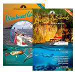
Cruising Guide to The Windward Islands, 2nd ed.
$
69.95
Stephen J. Pavlidis,
9781892399373
A Cruising Guide to the Windward Islands, 2nd ed. is the completely updated version of Steve Pavlidis comprehensive Windward Islands guide that covers the...
Quantity:
Add to Cart
Hawaii Seashore Life
$
7.95
8.25 x 3.69, James Kavanagh,
9781583558669
As important pollinators, butterflies help keep Hawaii's flowers blooming. Visitors and residents of the Aloha state will recognize the beauty of...
Quantity:
Add to Cart
Previous Page
1
2
3
4
5
6
Next Page