Cart is empty
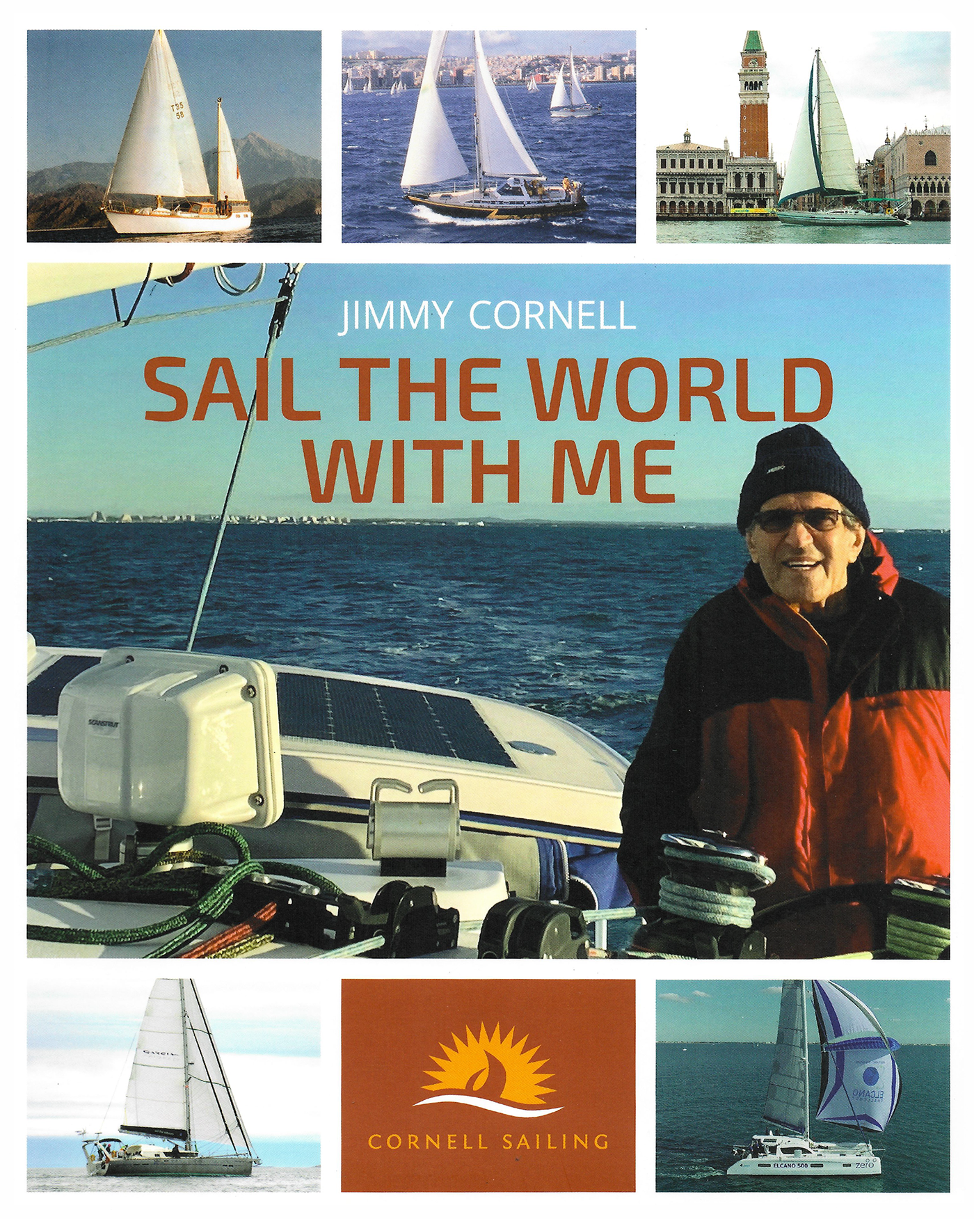
Sail The World With Me
Sail The World With Me deals with all essential aspects of offshore voyaging and long distance cruising. Every subject is dealt with in an informative and entertaining manner, backed up by telling incidents or anecdotes from the author’s wide-ranging experience.
While primarily aimed at sailors who are planning or making preparations for a longer voyage, this book will also appeal to tested ocean navigators as well as weekend sailors. The book’s attractive style, with over 600 excellent photographs from the author’s vast collection, should be equally appealing to dreamers.
Approximately two thirds of the book deals with practical matters and covers all subjects of interest to anyone planning to leave on an offshore voyage. The other third of the book describes highlights from the author’s circumnavigations as well as voyages to Antarctica, a transpacific passage from Antarctica to Alaska, or the challenges of the Northwest Passage.
Sail The World With Me, Jimmy Cornell’s latest book, is based on his extensive knowledge of offshore cruising gained from an experience that stretches over four decades. Sail The World With Me supersedes 200,000 Miles, and has been updated and revised to include Jimmy’s latest adventures with his fifth boat, Aventura Zero and the challenges of zero-carbon sailing.
Jimmy has sailed over 200,000 miles in all oceans of the world, including three circumnavigations as well as two voyages to Antarctica and a successful transit of the Northwest Passage. As the founder of the ARC transatlantic rally, in the last 30 years Jimmy Cornell has organized 28 transatlantic and six round the world rallies.
As organizer of these events, he has come into contact with over 15,000 sailors and the experience gained from dealing with so many different boats and sailors has been an invaluable source of knowledge of the global cruising scene that adds a special dimension to this book.
Specifications
Dimensions (IN):
9.5 x 8
Pages:
395 pages
Author:
Jimmy Cornell
Supplier/Publisher:
Cornell Sailing
Published Date:
2021
ISBN:
9781916091054
Date Added:
DEC 2022
Format:
Flexi
Material Options
 Our paper charts are printed on high resolution, heavyweight, water-resistant paper, using state of the art printing technology. The paper and printing process has been certified by NOAA and deemed to be suitable to withstand the rigors of use in the marine environment. FULL SIZED PAPER CHARTS ARE CERTIFIED FOR CARRIAGE ABOARD COMMERCIAL VESSELS |
 Our waterproof charts are printed on a TIP: If you plan to frame or laminate a chart using heat, then do not choose waterproof because the material can melt under heat. FULL SIZED WATERPROOF CHARTS ARE CERTIFIED FOR CARRIAGE ABOARD COMMERCIAL VESSELS |
Size Options |
|
|
|
 These are up-to-date, NOAA charts simply enlarged in size so that the small dimension of the chart is 42”, the long dimension is proportionally enlarged. These charts are printed beyond full size, therefore the scale is not the same as the full size NOAA chart, however the scale bars on the charts are proportionally enlarged in size, and can be used for reference. LARGE FORMAT CHARTS ARE NOT CERTIFIED FOR CARRIAGE ABOARD COMMERCIAL VESSELS |
Other Options |
|
|
|
 Made to help recreational boaters locate themselves on the water. It has been reduced in scale for convenience, but otherwise contains all the information of the full-scale nautical chart. The bar scales have also been reduced, and are accurate when used to measure distances in these BookletCharts. • Professionally printed and staple-bound using high quality, durable paper. • Includes Notices to Mariners • Printed on-demand with the latest data from NOAA BOOKLET CHARTS ARE NOT CERTIFIED FOR CARRIAGE ABOARD COMMERCIAL VESSELS |
 |
This is a unique line of decorative charts prepared by Paradise Cay Publications.
The short side of the chart is always printed at 36" and the long side will vary depending on the chart - please do not order framing prior to receiving the chart. These will memorialize your favorite coastal area in vintage style and we have added to the standard border of the typical NOAA chart to allow for a more professional, frame-ready presentation. DECORATIVE CHARTS ARE NOT CERTIFIED FOR CARRIAGE ABOARD COMMERCIAL VESSELS |


No reviews found
