Cart is empty
Cart is empty
View cart
Checkout
Account
View Previous Orders
Favorites
Sign in
Create an Account
Email
Password
Forgot password?
Create a new basic account
Sign in
Remember me
Cart is empty
Cart is empty
View cart
Checkout
Account
View Previous Orders
Favorites
Sign in
Create an Account
Email
Password
Forgot password?
Create a new basic account
Sign in
Remember me
Menu
NOAA Nautical Charts for U.S. Waters
8.5 x 11 BookletCharts
NOAA Atlantic Coast charts
NOAA Pacific Coast charts
NOAA Alaska Coast charts
NOAA Gulf Coast charts
NOAA Great Lakes charts
NOAA Training Charts
NOAA Custom Charts (NCC's)
Worldwide Nautical Charts
Canadian (CHS) Charts
NGA Charts: Region 1 - North America
NGA Charts: Region 2 - Central, South America
NGA Charts: Region 3 - UK, Western Europe
NGA Charts: Region 4 - Scandinavia, Northern Russia
NGA Charts: Region 5 - Western Africa, Mediterranean, Black Sea
NGA Charts: Region 6 - Eastern Africa, Southern & Western Asia
NGA Charts: Region 7 - South East Asia, Indonesia, New Guinea, Australia
NGA Charts: Region 8 - Pacific Islands
NGA Charts: Region 9 - Eastern Asia, South Eastern Russia, Philippines
NGA Charts: Miscellaneous
Nautical Publications
U.S. Chart No.1
USCG Navigation Rules Handbook
Nautical Almanac
U.S. Coast Pilot
USCG Light Lists
Tide and Tidal Current Tables
American Practical Navigator - Bowditch
Sight Reduction Tables
Code of Federal Regulations (CFR)
Atlas of Pilot Charts
NGA List of Lights
View more
→
Nautical Books
Chartbooks & Cruising Guides
Boating Skills & How-To
Boats
Other
Logbooks
Myerchin Rigging Knives
Professional
Mariner Training
Navigation Tools
Bestsellers in this Category
Cornell's Ocean Atlas 3rd Edition
CCA Essential Passage Guide to the Viking Route
Chesapeake Bay Chart Atlas (12x18 spiral-bound)
Great Lakes Chart Atlas (Lake Michigan & Lake Superior) 12x18 Spiral-bound
Florida Keys Chart Atlas (12x18 Spiral-bound)
World Cruising Destinations 3rd Edition
Southeast Atlantic Coast Chart Atlas (12x18 Spiral-bound)
Gulf Coast Texas to Mississippi Chart Atlas (12x18 Spiral-Bound)
Chartbooks & Cruising Guides
Charlie's Charts
Cruising Guide Publications
Evergreen Publishing
Imray Guides
Jimmy Cornell Books
Sea Trail Maps
Seaworthy Publications
Waterway Guides
Yachtsman Chart Books
International Chartbooks & Cruising Guides
U.S. Region Cruising Guides
Sort by Bestselling
Newest Items First
Sort Alphabetically: A to Z
Sort Alphabetically: Z to A
Sort by Price: Low to High
Sort by Price: High to Low
24 Per Page
16 Per Page
32 Per Page
64 Per Page
128 Per Page
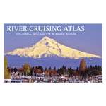
River Cruising Atlas: Columbia, Snake, Willamette, 2014 Edition
$
59.99
9781934707210
This popular atlas of the Columbia, Snake and Willamette rivers contains large-scale reproductions of NOAA charts for the Columbia River from its mouth to...
Quantity:
Add to Cart
Cruising Guide to the Southern Leeward Islands 2018-2019 Edition
$
34.95
6 x 9 x 1, Chris Doyle and Lexi Fisher,
9798986585857
This 15th edition (2018-2019) is split into two guides, The Cruising Guide to the Northern Leeward Islands and The Cruising Guide to the...
Availability:
8000 item(s)
Quantity:
Add to Cart
Yachtsman Northwest Chart Book, 3rd edition
$
39.95
16.75 x 12
Covers Washington waters from the Columbia River to the Canadian border including Puget Sound and the San Juan Islands. NOS charts are reprinted along with...
Quantity:
Add to Cart
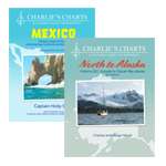
Charlie's Charts: HAWAIIAN ISLANDS
$
34.95
8.5 x 11, Charles and Margo Wood,
9781937196400
This guide has a detailed sketch of all anchorages and marina facilities in the Hawaiian Islands. The introduction discusses significant topics such as...
Availability:
8005 item(s)
Quantity:
Add to Cart
Chesapeake Bay Chart Atlas (12x18 spiral-bound)
$
44.95
NOAA Charts, 12 x 18,
9781951116354
Over 50 reduced-scale complete NOAA charts of the Chesapeake Bay and surrounding area. Spiral-bound in a large format (12x18") booklet. Printed on...
Availability:
7997 item(s)
Quantity:
Add to Cart
Cruising Guide to Puerto Rico, 3rd Edition
$
54.95
8 x 11, Stephen Pavlidis,
9781892399397
A complete guide to cruising in Puerto Rico including the Spanish Virgin Islands with 53 detailed, full-color charts, color photos, GPS waypoints, piloting...
Quantity:
Add to Cart
Great Lakes Chart Atlas (Lake Michigan & Lake Superior) 12x18 Spiral-bound
$
44.95
NOAA Charts, 12 x 18,
9781951116248
84 reduced-scale complete NOAA charts of Lake Michigan, Lake Superior and Lake Erie. Spiral bound in a large format (12x18") booklet. Printed on...
Availability:
8009 item(s)
Quantity:
Add to Cart
Florida Keys Chart Atlas (12x18 Spiral-bound)
$
34.95
NOAA Charts, 12 x 18,
9781951116262
25 reduced-scale complete NOAA charts of The Florida Keys and surrounding areas. Spiral bound in a large format (12x18") booklet. Printed on high-quality...
Availability:
7999 item(s)
Quantity:
Add to Cart
Jimmy Cornell 3-PACK (Includes Destinations, Routes & Planner)
$
130.99
Spceial Offer
Availability:
5010 item(s)
Quantity:
Add to Cart
Cruising Atlas for Northwest Waters 2019 Edition
$
69.99
16.8 x 12, Evergreen Pacific,
9781934707111
Major updates throughout as of December 2019! It's like having 8 atlases in one! This large scale, large coverage atlas contains the reproduction of...
Quantity:
Add to Cart
World Cruising Destinations 3rd Edition
$
59.95
7.5 x 9.5, Jimmy Cornell,
9781916091061
NOW SHIPPING
Availability:
8023 item(s)
Quantity:
Add to Cart
Panama Guide, 2nd edition
$
39.95
8 x 10, Nancy Schwalbe Zydler & Tom Zydler,
9781892399090
Comprehensive cruising guide for all of the waters surrounding Panama, plus its navigable rivers, the San Blas Islands and Las Perlas.
Quantity:
Add to Cart
Child of the Sea
$
19.95
Doina Cornell,
9780955639692
In 1975 Doina Cornell left England with her family when she was only seven and spent the next six years sailing around the world on a small yacht. The...
Quantity:
Add to Cart
Fish-n-Map: Strait of Georgia, Vancouver & Nanaimo to Courtenay & Powell River
$
16.95
9 x 4.2 Folded,
761428101013
Contours: 5 meter Scale: 1:100,000 GPS Data: Yes Water Type: Salt Region/State(s): Canada Price: ...
Availability:
8008 item(s)
Quantity:
Add to Cart
San Francisco Bay Area Chart Atlas (12x18 Spiral-Bound)
$
29.95
NOAA Charts, 12 x 18,
9781951116224
19 reduced-scale complete NOAA charts of the San Francisco Bay Area andsurrounding areas. Spiral bound in a large format (12x18") booklet. Printed on...
Availability:
8002 item(s)
Quantity:
Add to Cart
Santa Barbara to San Diego Chart Atlas (12x18 Spiral-bound)
$
29.95
NOAA Charts, 12 x 18,
9781951116279
24 reduced-scale complete NOAA charts coverign the area from Santa Barbara, CA to San Diego, CA, including Los Angeles. Spiral bound in a large format...
Availability:
8000 item(s)
Quantity:
Add to Cart
Yachtsman Oregon Chart Book, 3rd edition
$
22.95
16.75 x 12
An atlas of reprinted NOAA charts enhanced with supplementary information for cruising the coast of Oregon including Columbia and Willamette Rivers to...
Quantity:
Add to Cart
Southeast Atlantic Coast Chart Atlas (12x18 Spiral-bound)
$
45.95
NOAA Charts, 12 x 18,
9781951116422
54 reduced-scale complete NOAA charts of the Atlantic Coast of the U.S. from N. Florida to North Carolina. Spiral-bound in a large format (12x18") booklet....
Availability:
8002 item(s)
Quantity:
Add to Cart
Southern Bahamas, Vol. 2
$
64.95
8 x 11, Stephen Pavlidis,
9781892399298
From Cat Island South to the Turks & Caicos~Dominican Republic North Coast Cat Island The Jumentos Conception Island and Ragged Island Rum Cay The...
Quantity:
Add to Cart
Cruising Guide to the Northern Leeward Islands 2018-2019 Edition
$
34.95
9 x 6 x 1, Chris Doyle and Lexi Fisher,
9798986585840
This 15th edition (2018-2019) is split into two guides, The Cruising Guide to the Northern Leeward Islands and The Cruising Guide to the Southern...
Availability:
8000 item(s)
Quantity:
Add to Cart
Fish-n-Map: Sea of Cortez North, San Felipe to Mulege
$
16.95
9 x 4.2 Folded,
761428071231
Printed on a waterproof, tear-resistant plastic Folds to 3" x 4", Unfolds to 3' x 2' FEATURES: 30 Foot Underwater Depth Contours for Easy Structure...
Availability:
8005 item(s)
Quantity:
Add to Cart
Fish-n-Map: Sea of Cortez South, Loreto through Cabo San Lucas
$
16.95
9 x 4.2 Folded,
761428071248
Contours: 30' Scale: 1:160,000 / Cabo San Lucas 1:167,000 / Las Paz to Cabo 1:334,000 GPS Data: No Water Type: Salt...
Availability:
8003 item(s)
Quantity:
Add to Cart
Waterway Guide: CUBA 2nd Ed. Revised
$
59.99
9 x 11,
9780998586342
Waterway Guide Cuba covers the country's entire coast and is the perfect companion whether visiting for a few days or circumnavigating the island. Detailed...
Availability:
8000 item(s)
Quantity:
Add to Cart
Columbia River Chart Atlas (12x18 Spiral-Bound)
$
34.95
NOAA Charts, 12 x 18
22 reduced-scale complete NOAA charts of the Columbia River and surrounding areas. Spiral bound in a large format (12x18") booklet. Printed on high-quality...
Availability:
8003 item(s)
Quantity:
Add to Cart
Previous Page
1
2
3
4
5
6
Next Page