Cart is empty
Wind Companion for Racing Sailors
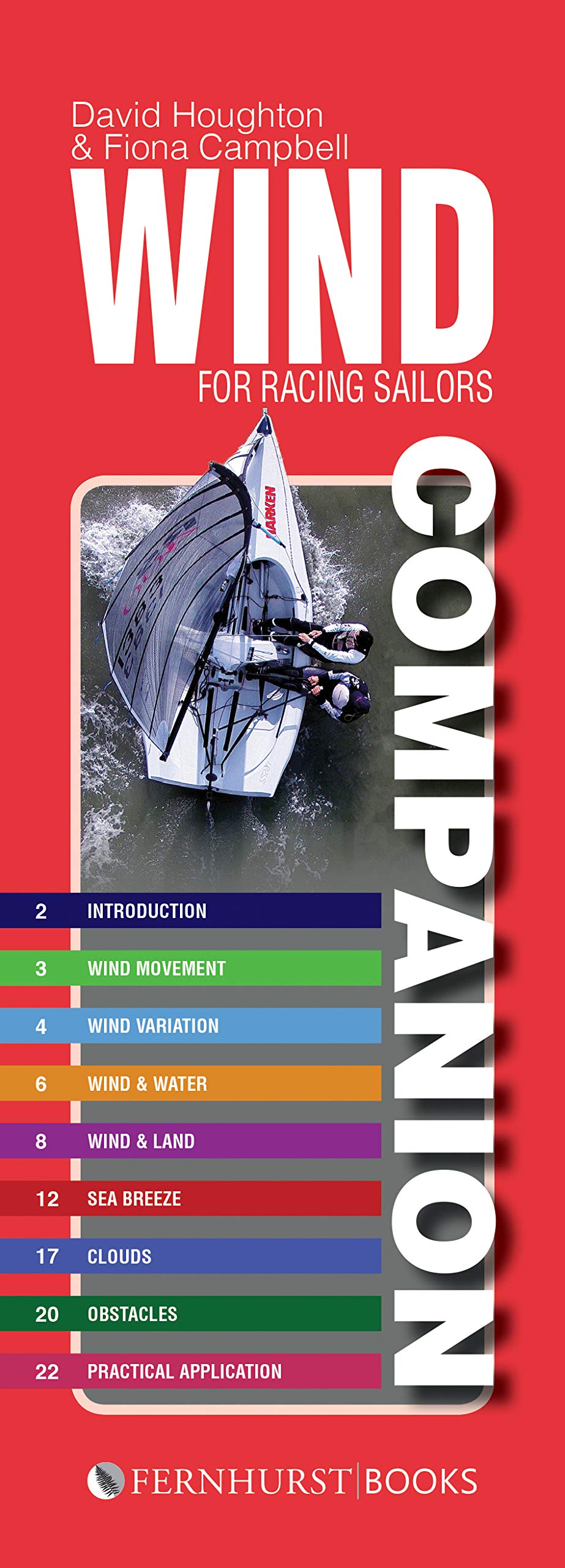
Out of all the explanations for why a sailor has lost out on a race, an unforeseen change in the wind and weather is by far one of the most frequent. Whether a bad windshift; the non-occurrence of a sea breeze; or being becalmed, the weather has a huge impact on racing. However, it is not hard to turn these problems around. This handy guide has all you need to work out the best way to use the wind to your advantage and boost you up the fleet.
The book covers all the essentials for racing, from why gusts form and where to find them, to the formation of the sea breeze (which is never quite as simple as first appears!). Splash-proof and spiral bound, this little companion stands up to frequent use and serves as a great aide-memoire that will fit into your pocket or kit bag, meaning that you can always work out a detailed forecast for your specific racing area, regardless of whether you are on home territory or on completely new waters.
Wind Companion also clearly and simply develops a more advanced understanding of the wind, such as which clouds indicate weather fronts and when they may occur. This will also allow you to identify and adapt to changes on the water and even during races, giving you a significant advantage over your competition. Such adaptability will give you the opportunity to beat even knowledgeable locals, as there will always be occasions when the wind does something unexpected – but which can always be explained by the wind-wise sailor.
Written by two acclaimed meteorologists, David Houghton and Fiona Campbell, who have advised top sailing teams at all of the big regattas, from Olympics to the America’s Cup, you can’t go far wrong! This book, based on their best-selling Wind Strategy, is packed full of vital information and clear diagrams to visualise the invisible and is a key resource for anyone looking to advance their sailing knowledge and results.
Specifications
Dimensions (IN):
3 x 9.5
Pages:
24 pages
Author:
David Houghton & Fiona Campbell
Published Date:
2020
ISBN:
9781912621064
Date Added:
JUNE 2020
Format:
spiral-bound
Material Options
 Our paper charts are printed on high resolution, heavyweight, water-resistant paper, using state of the art printing technology. The paper and printing process has been certified by NOAA and deemed to be suitable to withstand the rigors of use in the marine environment. FULL SIZED PAPER CHARTS ARE CERTIFIED FOR CARRIAGE ABOARD COMMERCIAL VESSELS |
 Our waterproof charts are printed on a TIP: If you plan to frame or laminate a chart using heat, then do not choose waterproof because the material can melt under heat. FULL SIZED WATERPROOF CHARTS ARE CERTIFIED FOR CARRIAGE ABOARD COMMERCIAL VESSELS |
Size Options |
|
|
|
 These are up-to-date, NOAA charts simply enlarged in size so that the small dimension of the chart is 42”, the long dimension is proportionally enlarged. These charts are printed beyond full size, therefore the scale is not the same as the full size NOAA chart, however the scale bars on the charts are proportionally enlarged in size, and can be used for reference. LARGE FORMAT CHARTS ARE NOT CERTIFIED FOR CARRIAGE ABOARD COMMERCIAL VESSELS |
Other Options |
|
|
|
 Made to help recreational boaters locate themselves on the water. It has been reduced in scale for convenience, but otherwise contains all the information of the full-scale nautical chart. The bar scales have also been reduced, and are accurate when used to measure distances in these BookletCharts. • Professionally printed and staple-bound using high quality, durable paper. • Includes Notices to Mariners • Printed on-demand with the latest data from NOAA BOOKLET CHARTS ARE NOT CERTIFIED FOR CARRIAGE ABOARD COMMERCIAL VESSELS |
 |
This is a unique line of decorative charts prepared by Paradise Cay Publications.
The short side of the chart is always printed at 36" and the long side will vary depending on the chart - please do not order framing prior to receiving the chart. These will memorialize your favorite coastal area in vintage style and we have added to the standard border of the typical NOAA chart to allow for a more professional, frame-ready presentation. DECORATIVE CHARTS ARE NOT CERTIFIED FOR CARRIAGE ABOARD COMMERCIAL VESSELS |


No reviews found
