Cart is empty
Sailing for Dummies, 3rd edition
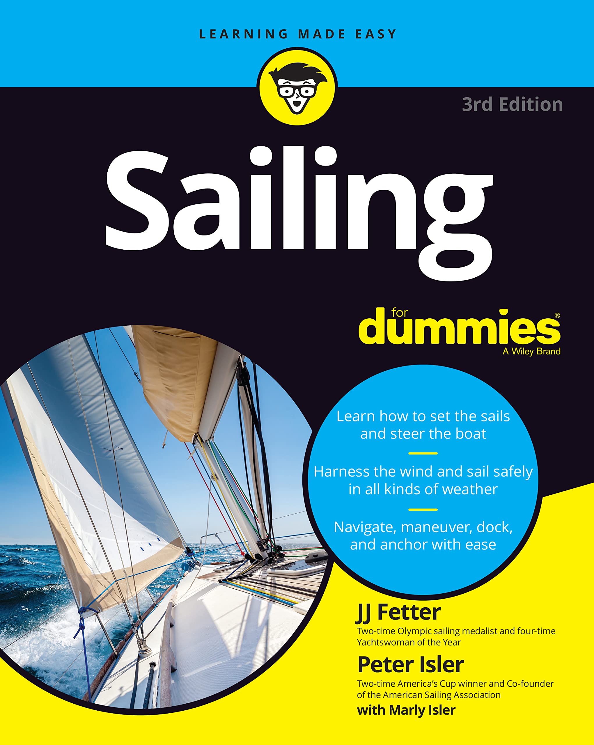
Buoy your sailing knowhow with advice from two US sailing champions
Nothing can beat the feel of the warm sun on your back, the gentle wind in your hair, and a swaying deck under your feet. If you long to take to the open water and sail wherever the wind takes you, you’ll find everything you need to know in Sailing For Dummies. This friendly guide offers information for beginning and intermediate captains. Discover everything you need to know to confidently navigate your vessel through whatever waters―rough or smooth―you may encounter. Whether your goal is to explore a nearby lake, sail down the Mighty Mississippi, or take to the open sea, Sailing For Dummies explains how to launch your vessel, tie knots, turn sails, read the water, and more.
- Figure out how to work with the wind using sails to reach your destination
- Find out how the latest technology makes sailing easier and more enjoyable
- Master the essential skills of docking, tying knots, and dropping anchor
- Learn how to read the wind, sea, and sky to know what the weather is up to
- Choose the boat that’s right for you, complete with bells and whistles
- Discover the basics of windsurfing and kiteboarding
- Satisfy your need to go farther and faster in your craft
- Know how to sail safely in tricky situations
Whether you’re dipping your toe in the water or knee deep in your pursuit of sailing excellence, this reference will come in handy as you set your sights on sailing. After spending some time with Sailing For Dummies―and even more time on the water―you’ll know the ropes!
Specifications
Dimensions (IN):
7.5 x 9.5
Pages:
448 pages
Author:
J.J. Isler & Peter Isler
Supplier/Publisher:
Wiley Nautical
Published Date:
2022
ISBN:
9781119867234
Date Added:
March 2023
Format:
Paperback
Material Options
 Our paper charts are printed on high resolution, heavyweight, water-resistant paper, using state of the art printing technology. The paper and printing process has been certified by NOAA and deemed to be suitable to withstand the rigors of use in the marine environment. FULL SIZED PAPER CHARTS ARE CERTIFIED FOR CARRIAGE ABOARD COMMERCIAL VESSELS |
 Our waterproof charts are printed on a TIP: If you plan to frame or laminate a chart using heat, then do not choose waterproof because the material can melt under heat. FULL SIZED WATERPROOF CHARTS ARE CERTIFIED FOR CARRIAGE ABOARD COMMERCIAL VESSELS |
Size Options |
|
|
|
 These are up-to-date, NOAA charts simply enlarged in size so that the small dimension of the chart is 42”, the long dimension is proportionally enlarged. These charts are printed beyond full size, therefore the scale is not the same as the full size NOAA chart, however the scale bars on the charts are proportionally enlarged in size, and can be used for reference. LARGE FORMAT CHARTS ARE NOT CERTIFIED FOR CARRIAGE ABOARD COMMERCIAL VESSELS |
Other Options |
|
|
|
 Made to help recreational boaters locate themselves on the water. It has been reduced in scale for convenience, but otherwise contains all the information of the full-scale nautical chart. The bar scales have also been reduced, and are accurate when used to measure distances in these BookletCharts. • Professionally printed and staple-bound using high quality, durable paper. • Includes Notices to Mariners • Printed on-demand with the latest data from NOAA BOOKLET CHARTS ARE NOT CERTIFIED FOR CARRIAGE ABOARD COMMERCIAL VESSELS |
 |
This is a unique line of decorative charts prepared by Paradise Cay Publications.
The short side of the chart is always printed at 36" and the long side will vary depending on the chart - please do not order framing prior to receiving the chart. These will memorialize your favorite coastal area in vintage style and we have added to the standard border of the typical NOAA chart to allow for a more professional, frame-ready presentation. DECORATIVE CHARTS ARE NOT CERTIFIED FOR CARRIAGE ABOARD COMMERCIAL VESSELS |


No reviews found
