Cart is empty
Reeds Lights, Shapes and Buoyage Handbook
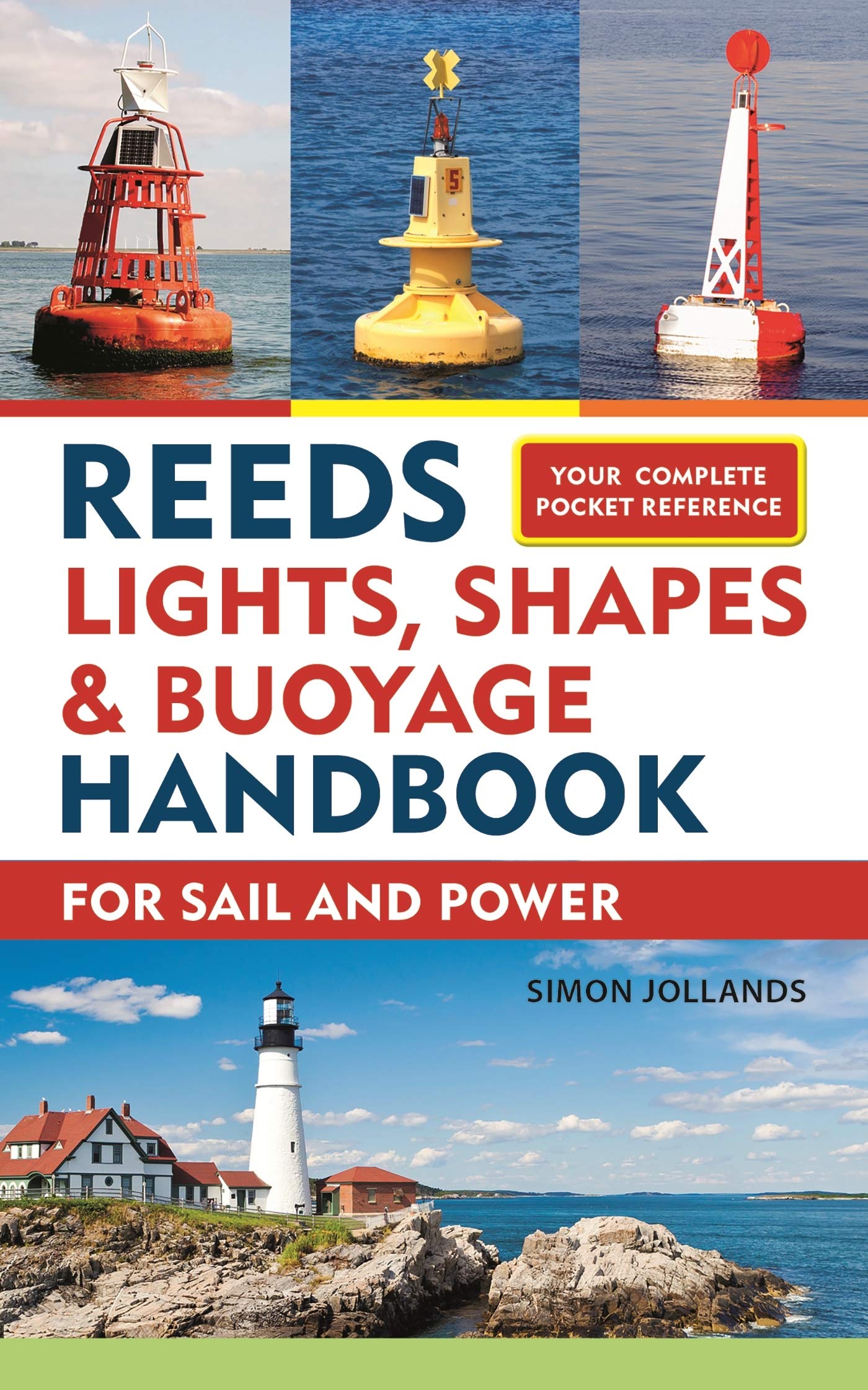
This pocket-sized guide is a quick reference for all seafarers to the essential navigational lights, shapes, and seamarks which abound off the coastline all over the world.
Laid out simply & clearly for quick accessibility, it enables crew, navigators, skippers and even casual day guests aboard to quickly identify the lights, marks and shapes being displayed by other ships at night as well as during the day. It's easy to confuse (or forget) what particular lights, marks and shapes mean--especially under stress or in the dark--but with this handy book, help is quickly at hand.
A ready reckoner reminder of:
-Cardinal buoys and channel markers
-Lights displayed by ships at night (tugs, dredgers, pilot vessels, stationary vessels, fishing boats, yachts, motorboats) and from all aspects (front, side, astern)
-Daytime shapes displayed by boats (e.g. for anchoring, towing, diving, dredging)
-Ships' sound signals (used in fog)
-Signal flags and their navigational meanings (I am dragging my anchor; You are running into danger; I have a diver down).
These lights, shapes and marks are applicable worldwide, by maritime law, which makes this international handbook a valuable and popular addition to the Reeds Handbook series.
Specifications
Dimensions (IN):
4.25 x 6.5
Pages:
128 pages
Author:
Simon Jollands
Supplier/Publisher:
Adlard Coles
Published Date:
2019
ISBN:
9781472965097
Date Added:
January 2020
Format:
Paperback
Material Options
 Our paper charts are printed on high resolution, heavyweight, water-resistant paper, using state of the art printing technology. The paper and printing process has been certified by NOAA and deemed to be suitable to withstand the rigors of use in the marine environment. FULL SIZED PAPER CHARTS ARE CERTIFIED FOR CARRIAGE ABOARD COMMERCIAL VESSELS |
 Our waterproof charts are printed on a TIP: If you plan to frame or laminate a chart using heat, then do not choose waterproof because the material can melt under heat. FULL SIZED WATERPROOF CHARTS ARE CERTIFIED FOR CARRIAGE ABOARD COMMERCIAL VESSELS |
Size Options |
|
|
|
 These are up-to-date, NOAA charts simply enlarged in size so that the small dimension of the chart is 42”, the long dimension is proportionally enlarged. These charts are printed beyond full size, therefore the scale is not the same as the full size NOAA chart, however the scale bars on the charts are proportionally enlarged in size, and can be used for reference. LARGE FORMAT CHARTS ARE NOT CERTIFIED FOR CARRIAGE ABOARD COMMERCIAL VESSELS |
Other Options |
|
|
|
 Made to help recreational boaters locate themselves on the water. It has been reduced in scale for convenience, but otherwise contains all the information of the full-scale nautical chart. The bar scales have also been reduced, and are accurate when used to measure distances in these BookletCharts. • Professionally printed and staple-bound using high quality, durable paper. • Includes Notices to Mariners • Printed on-demand with the latest data from NOAA BOOKLET CHARTS ARE NOT CERTIFIED FOR CARRIAGE ABOARD COMMERCIAL VESSELS |
 |
This is a unique line of decorative charts prepared by Paradise Cay Publications.
The short side of the chart is always printed at 36" and the long side will vary depending on the chart - please do not order framing prior to receiving the chart. These will memorialize your favorite coastal area in vintage style and we have added to the standard border of the typical NOAA chart to allow for a more professional, frame-ready presentation. DECORATIVE CHARTS ARE NOT CERTIFIED FOR CARRIAGE ABOARD COMMERCIAL VESSELS |


No reviews found
