Cart is empty
NOAA BookletChart 12221: Chesapeake Bay Entrance
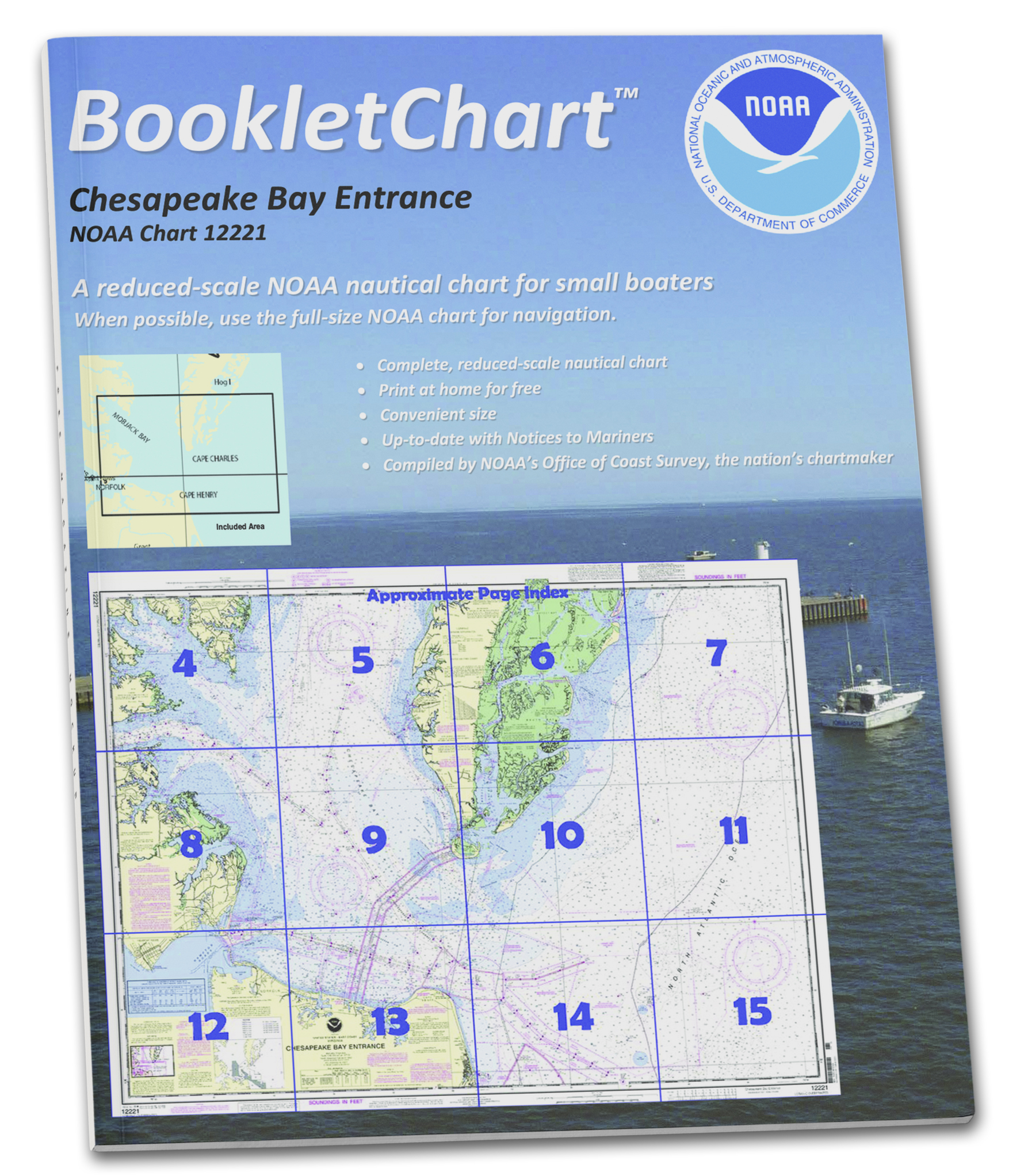
• An alternative to large, full scale charts which may too big to manage, especially on the water in a small vessel.
• Exact replica of the full scale version of the corresponding NOAA Chart 12221, just printed in smaller scale and offered in a booklet form.
• Your Booklet chart will be printed on demand for your order and will include all updates at the time of printing.
• Printed on high-quality durable paper with stapled (saddle-stitched) binding.
• Handy 8.5 x 11 inch size. Page count varies depending on the chart.
This BookletChart is made to help recreational boaters locate themselves on the water. It has been reduced in scale for convenience, but otherwise contains all the information of the full-scale nautical chart. The bar scales have also been reduced, and are accurate when used to measure distances in this BookletChart. This BookletChart does NOT fulfill chart carriage requirements for regulated commercial vessels under Titles 33 and 44 of the Code of Federal Regulations but it has been updated for chart corrections published in the U.S. Coast Guard Local Notice to Mariners, the National Geospatial Intelligence Agency Weekly Notice to Mariners, and, where applicable, the Canadian Coast Guard Notice to Mariners. These BookletCharts have been one of NOAA’s handiest navigation products, especially for recreational boaters. The began as a Coast Survey’s experimental butr because of their success they have now moved the BookletCharts from experimental stage into official production. Nearly 1,000 newly updated BookletCharts are available, they cover the 95,000 miles of U.S. coastline and the Great Lakes. These handy BookletCharts are smaller scale than our traditional paper charts, but they contain most of the information found on a full-scale nautical chart. NOAA’s nautical charts help to protect lives and property, and boaters should take advantage of these nautical products. Many boaters don’t use nautical charts, trusting local knowledge or their memories. But that can be dangerous, as seafloors constantly shift, shorelines erode, and dangers to navigation are discovered. BookletCharts will tell a boater about these developments, and will help ensure a safe voyage, whether it is around the bay or down the coast.
Specifications
Nautical Chart Type:
NOAA Charts
Dimensions (IN):
8.5" x 11"
Material Options
 Our paper charts are printed on high resolution, heavyweight, water-resistant paper, using state of the art printing technology. The paper and printing process has been certified by NOAA and deemed to be suitable to withstand the rigors of use in the marine environment. FULL SIZED PAPER CHARTS ARE CERTIFIED FOR CARRIAGE ABOARD COMMERCIAL VESSELS |
 Our waterproof charts are printed on a TIP: If you plan to frame or laminate a chart using heat, then do not choose waterproof because the material can melt under heat. FULL SIZED WATERPROOF CHARTS ARE CERTIFIED FOR CARRIAGE ABOARD COMMERCIAL VESSELS |
Size Options |
|
|
|
 These are up-to-date, NOAA charts simply enlarged in size so that the small dimension of the chart is 42”, the long dimension is proportionally enlarged. These charts are printed beyond full size, therefore the scale is not the same as the full size NOAA chart, however the scale bars on the charts are proportionally enlarged in size, and can be used for reference. LARGE FORMAT CHARTS ARE NOT CERTIFIED FOR CARRIAGE ABOARD COMMERCIAL VESSELS |
Other Options |
|
|
|
 Made to help recreational boaters locate themselves on the water. It has been reduced in scale for convenience, but otherwise contains all the information of the full-scale nautical chart. The bar scales have also been reduced, and are accurate when used to measure distances in these BookletCharts. • Professionally printed and staple-bound using high quality, durable paper. • Includes Notices to Mariners • Printed on-demand with the latest data from NOAA BOOKLET CHARTS ARE NOT CERTIFIED FOR CARRIAGE ABOARD COMMERCIAL VESSELS |
 |
This is a unique line of decorative charts prepared by Paradise Cay Publications.
The short side of the chart is always printed at 36" and the long side will vary depending on the chart - please do not order framing prior to receiving the chart. These will memorialize your favorite coastal area in vintage style and we have added to the standard border of the typical NOAA chart to allow for a more professional, frame-ready presentation. DECORATIVE CHARTS ARE NOT CERTIFIED FOR CARRIAGE ABOARD COMMERCIAL VESSELS |


No reviews found
