Cart is empty
HO-249 Air Navigation Volume 1 Selected Stars – Epoch 2025
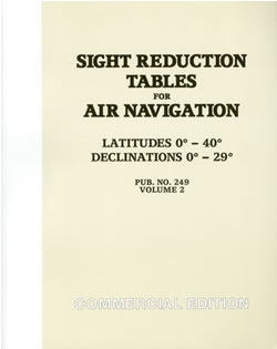
These tables were designed for air navigation where weight and space are at a premium, however, they are very popular with sailors too due to the fact that Vol. 1 offers a speedier way to compute stars. The way the 6 volumes of 229 were combined into this 3 volume set is this: volumes 2 & 3 cover all latitudes, but work only for declinations from 0° to 29° north or south. This covers the sun, moon, planets, and only those stars whose declinations fall into this range. Volume 1 contains some stars (whose declinations may be more than 29°) that are pre-selected for optimum viewing and direction. This volume is applicable for an 8 year period, centered on its Epoch date. The only drawback to this arrangement, is that it is possible that a star may be observed that is not one of the pre-selected ones, and whose declination is more than 29° north or south. This star, if observed on some unlikely occasion, say through a break in the overcast, could not be computed using the 249 tables. Nevertheless this remains the most popular tabular system in use.
Because of the high price and spotty availability of the Government editions, we have reprinted these as Commercial Editions from official Government electronic files or software. They are economical, and sized at 90% of the originals. They have soft instead of hard covers and their smaller size of 8.5 x 11 inches is easier to carry and store. SW 2.1 lbs
Specifications
Dimensions (IN):
8.5 x 11
Supplier/Publisher:
Celestaire
Format:
Paperback
Material Options
 Our paper charts are printed on high resolution, heavyweight, water-resistant paper, using state of the art printing technology. The paper and printing process has been certified by NOAA and deemed to be suitable to withstand the rigors of use in the marine environment. FULL SIZED PAPER CHARTS ARE CERTIFIED FOR CARRIAGE ABOARD COMMERCIAL VESSELS |
 Our waterproof charts are printed on a TIP: If you plan to frame or laminate a chart using heat, then do not choose waterproof because the material can melt under heat. FULL SIZED WATERPROOF CHARTS ARE CERTIFIED FOR CARRIAGE ABOARD COMMERCIAL VESSELS |
Size Options |
|
|
|
 These are up-to-date, NOAA charts simply enlarged in size so that the small dimension of the chart is 42”, the long dimension is proportionally enlarged. These charts are printed beyond full size, therefore the scale is not the same as the full size NOAA chart, however the scale bars on the charts are proportionally enlarged in size, and can be used for reference. LARGE FORMAT CHARTS ARE NOT CERTIFIED FOR CARRIAGE ABOARD COMMERCIAL VESSELS |
Other Options |
|
|
|
 Made to help recreational boaters locate themselves on the water. It has been reduced in scale for convenience, but otherwise contains all the information of the full-scale nautical chart. The bar scales have also been reduced, and are accurate when used to measure distances in these BookletCharts. • Professionally printed and staple-bound using high quality, durable paper. • Includes Notices to Mariners • Printed on-demand with the latest data from NOAA BOOKLET CHARTS ARE NOT CERTIFIED FOR CARRIAGE ABOARD COMMERCIAL VESSELS |
 |
This is a unique line of decorative charts prepared by Paradise Cay Publications.
The short side of the chart is always printed at 36" and the long side will vary depending on the chart - please do not order framing prior to receiving the chart. These will memorialize your favorite coastal area in vintage style and we have added to the standard border of the typical NOAA chart to allow for a more professional, frame-ready presentation. DECORATIVE CHARTS ARE NOT CERTIFIED FOR CARRIAGE ABOARD COMMERCIAL VESSELS |


No reviews found
