Cart is empty
Cart is empty
View cart
Checkout
Account
View Previous Orders
Favorites
Sign in
Create an Account
Email
Password
Forgot password?
Create a new basic account
Sign in
Remember me
Cart is empty
Cart is empty
View cart
Checkout
Account
View Previous Orders
Favorites
Sign in
Create an Account
Email
Password
Forgot password?
Create a new basic account
Sign in
Remember me
Menu
NOAA Nautical Charts for U.S. Waters
8.5 x 11 BookletCharts
NOAA Atlantic Coast charts
NOAA Pacific Coast charts
NOAA Alaska Coast charts
NOAA Gulf Coast charts
NOAA Great Lakes charts
NOAA Training Charts
NOAA Custom Charts (NCC's)
Worldwide Nautical Charts
Canadian (CHS) Charts
NGA Charts: Region 1 - North America
NGA Charts: Region 2 - Central, South America
NGA Charts: Region 3 - UK, Western Europe
NGA Charts: Region 4 - Scandinavia, Northern Russia
NGA Charts: Region 5 - Western Africa, Mediterranean, Black Sea
NGA Charts: Region 6 - Eastern Africa, Southern & Western Asia
NGA Charts: Region 7 - South East Asia, Indonesia, New Guinea, Australia
NGA Charts: Region 8 - Pacific Islands
NGA Charts: Region 9 - Eastern Asia, South Eastern Russia, Philippines
NGA Charts: Miscellaneous
Nautical Publications
U.S. Chart No.1
USCG Navigation Rules Handbook
Nautical Almanac
U.S. Coast Pilot
USCG Light Lists
Tide and Tidal Current Tables
American Practical Navigator - Bowditch
Sight Reduction Tables
Code of Federal Regulations (CFR)
Atlas of Pilot Charts
NGA List of Lights
View more
→
Nautical Books
Chartbooks & Cruising Guides
Boating Skills & How-To
Boats
Other
Logbooks
Myerchin Rigging Knives
Professional
Mariner Training
Navigation Tools
Bestsellers in this Category
Cornell's Ocean Atlas 3rd Edition
CCA Essential Passage Guide to the Viking Route
Chesapeake Bay Chart Atlas (12x18 spiral-bound)
Great Lakes Chart Atlas (Lake Michigan & Lake Superior) 12x18 Spiral-bound
Florida Keys Chart Atlas (12x18 Spiral-bound)
World Cruising Destinations 3rd Edition
Southeast Atlantic Coast Chart Atlas (12x18 Spiral-bound)
Gulf Coast Texas to Mississippi Chart Atlas (12x18 Spiral-Bound)
Chartbooks & Cruising Guides
Charlie's Charts
Cruising Guide Publications
Evergreen Publishing
Imray Guides
Jimmy Cornell Books
Sea Trail Maps
Seaworthy Publications
Waterway Guides
Yachtsman Chart Books
International Chartbooks & Cruising Guides
U.S. Region Cruising Guides
Sort by Bestselling
Newest Items First
Sort Alphabetically: A to Z
Sort Alphabetically: Z to A
Sort by Price: Low to High
Sort by Price: High to Low
24 Per Page
16 Per Page
32 Per Page
64 Per Page
128 Per Page
2024 Waterway Guide - Bahamas - Book
$
54.99
9.25 x 10.5,
9798992518023
Updated annually, the Waterway Guide Bahamas 2024 edition is the indispensable cruising companion for boaters exploring the Bahamas Islands and...
Availability:
17 item(s)
Quantity:
Add to Cart
Inshore Britain (Imray)
$
69.95
8.25 x 11.75, Stuart Fisher,
9780852889060
Inshore Britain is an anthology of articles, each dealing with a particular stretch of coast around Britain, that were first published in the Canoeist...
Quantity:
Add to Cart
Forth, Tyne, Dogger, Humber, 5th edition (Imray)
$
44.95
8.5 X 11, Henry Iriving,
9780852885789
This new guide provides coverage north from the Humber. A detailed and entertaining guide to the remarkable variety of harbors and havens along the...
Quantity:
Add to Cart
Fearsome Passages (Imray)
$
64.95
7.25 x 9.75, David Rainsbury,
9780852888360
David Rainsbury's 'Fearsome Passages' is an anthology of his articles that have appeared over the last 2 years in Sailing Today magazine. 'Fearsome...
Quantity:
Add to Cart
Tidal Havens of the Wash and Humber, 6th edition (Imray)
$
24.95
Henry Irving,
9780852885079
Henry Irving's long established guide to the nooks and crannies of this fascinating corner of the North Sea is now in its 6th edition and is published in...
Quantity:
Add to Cart
The West Country (Imray)
$
49.95
Carlos Rojas and Susan KempWheeler,
9781846232022
The West Country is a brand new cruising guide covering Lyme Bay to Lands' End and the Isles of Scilly. It provides essential sailing directions and...
Quantity:
Add to Cart
The Black Sea, 1st edition (Imray)
$
83.95
11.5 x 8 x 0.5, RCCPF/David Read Barker and Lisa Borre,
9781846234125
Based on previously published cruising notes this guide provides sailing directions for all the countries surrounding the Black Sea. Packed with useful...
Quantity:
Add to Cart
South Biscay, 7th edition (Imray)
$
94.95
0.9 x 8.2 x 11.6, RCCPF/Steve Pickard,
9781846233753
This seventh edition of the RCC's South Biscay pilot covers the coasts of France and Spain from the Gironde to A Coruña in Galicia. This edition has...
Quantity:
Add to Cart
NAVIGATING THE THAMES THROUGH CENTRAL LONDON (Imray)
$
16.95
9.5 x 7.2 x 0.2, Robert Ludlow,
9781846234897
This small book is intended principally as a help to leisure boaters who are not familiar with the Thames through central London. However, Part 2 may well...
Quantity:
Add to Cart
Mediterranean France & Corsica Pilot, 6th edition
$
104.95
8.5 x 11, Rod Heikell,
9781846238499
This is a comprehensive companion to the long coastline which ranges from Spain and the edge of the Pyrenees to the Alpes Maritimes and Italy. It covers the...
Quantity:
Add to Cart
The Yachtman's Pilot to Skye and Northwest Scotland, 3rd Ed.
$
81.95
8.5 x 11.8, Martin Lawrence,
9781846231780
This pilot covers the most remote areas of the west coast of Scotland between Ardnamurchan Point and Cape Wrath and the Island of Skye. Martin Lawrence has...
Availability:
8000 item(s)
Quantity:
Add to Cart
Map of the Upper Reaches of The River Medway
$
20.95
9 x 6,
9781846234521
First published in the 1950s Imray's Map of the river above Rochester has always been popular with boaters. There is no other large scale map of the...
Availability:
8000 item(s)
Quantity:
Add to Cart
North Sea Passage Pilot REV 6TH ED
$
88.95
8.5 x 11, Brian Navin,
9781846239601
The author’s well-established guide to the East Coast of England, from Great Yarmouth to Dover and the corresponding coasts between Calais and Den...
Availability:
8000 item(s)
Quantity:
Add to Cart
East Coast Pilot: Great Yarmouth to Ramsgate 5TH ED
$
74.95
8.5 x 11, Garth Cooper and Dick Holness,
9781846239533
East Coast Pilot has become the bible for cruising sailors for the waters between Great Yarmouth and Ramsgate. Not only does it cover the many harbours,...
Availability:
8001 item(s)
Quantity:
Add to Cart
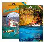
CRUISING GUIDE TO THE HAWAIIAN ISLANDS: 3rd Edition
$
49.95
8 x 10, Carolyn & Bob Mehaffy,
9781937196837
The CRUISING GUIDE TO THE HAWAIIAN ISLANDS is a boaters’ companion designed to aid resident and visiting boaters alike in their enjoyment of the...
Availability:
8015 item(s)
Quantity:
Add to Cart
River Thames Book 7th Edition
$
21.95
6.7 x 9.4, Chris Cove-Smith,
9781846237157
The River Thames Book, now in its seventh edition, is the best-selling guide to the non-tidal Thames from Teddington to its source in Gloucestershire. This...
Availability:
8000 item(s)
Quantity:
Add to Cart
Secret Anchorages of Brittany 3rd Edition
$
49.95
7.7 x 9.8, Peter Cumberlidge,
9781846238154
Secret Anchorages of Brittany provides concise pilotage directions for practically all the natural anchorages along the Brittany coast, from the Bay of Mont...
Availability:
8000 item(s)
Quantity:
Add to Cart
The River Great Ouse and Tributaries, 5th Edition
$
24.95
6.3 x 9.1, Andrew Hunter-Blair,
9781846238420
This is a guide for river users planning trips along the River Great Ouse from Denver to Bedford, including the River Wissey, Little Ouse or Brandon Creek,...
Availability:
8000 item(s)
Quantity:
Add to Cart
The River Nene
$
16.19
24 x 17, Roger Green,
9781786791634
With support from the Inland Waterways Association, Friends of the River Nene and others, and drawing on his longstanding connection with the river, Roger...
Availability:
8000 item(s)
Quantity:
Add to Cart
CCC Sailing Directions and Anchorages - Firth of Clyde
$
43.75
21 x 29.5, Clyde Cruising Club,
9781786791641
Part of the Clyde Cruising Club's Sailing Directions and Anchorages series, Firth of Clyde extends beyond its titled area to the coast of Northern Ireland...
Availability:
8000 item(s)
Quantity:
Add to Cart
Fenland Waterways: River Nene to River Great Ouse via Middle Level link route and alternatives
$
14.95
6.5 x 9.5
Spiral-bound
Availability:
8000 item(s)
Quantity:
Add to Cart
PUB 125: Sailing Directions Enroute West Coast of South America (CURRENT EDITION)
$
29.95
8.5 x 11
Printed on demand in house Always the most current edition Printed on 50# paper
Availability:
8001 item(s)
Quantity:
Add to Cart
Pub. 107 Atlas of Pilot Charts South Pacific
$
39.95
13 x 19
Spiral Bound 13 x 19 inches Printed on high quality paper
Availability:
8000 item(s)
Quantity:
Add to Cart
PUB. 150 World Port Index
$
24.95
8.5 x 11
The World Port Index (Pub 150) contains the location and physical characteristics of, and the facilities and services offered by major ports and terminals...
Availability:
8000 item(s)
Quantity:
Add to Cart
Previous Page
1
2
3
4
5
6
Next Page