Cart is empty
Cart is empty
View cart
Checkout
Account
View Previous Orders
Favorites
Sign in
Create an Account
Email
Password
Forgot password?
Create a new basic account
Sign in
Remember me
Cart is empty
Cart is empty
View cart
Checkout
Account
View Previous Orders
Favorites
Sign in
Create an Account
Email
Password
Forgot password?
Create a new basic account
Sign in
Remember me
Menu
NOAA Nautical Charts for U.S. Waters
8.5 x 11 BookletCharts
NOAA Atlantic Coast charts
NOAA Pacific Coast charts
NOAA Alaska Coast charts
NOAA Gulf Coast charts
NOAA Great Lakes charts
NOAA Training Charts
NOAA Custom Charts (NCC's)
Worldwide Nautical Charts
Canadian (CHS) Charts
NGA Charts: Region 1 - North America
NGA Charts: Region 2 - Central, South America
NGA Charts: Region 3 - UK, Western Europe
NGA Charts: Region 4 - Scandinavia, Northern Russia
NGA Charts: Region 5 - Western Africa, Mediterranean, Black Sea
NGA Charts: Region 6 - Eastern Africa, Southern & Western Asia
NGA Charts: Region 7 - South East Asia, Indonesia, New Guinea, Australia
NGA Charts: Region 8 - Pacific Islands
NGA Charts: Region 9 - Eastern Asia, South Eastern Russia, Philippines
NGA Charts: Miscellaneous
Nautical Publications
U.S. Chart No.1
USCG Navigation Rules Handbook
Nautical Almanac
U.S. Coast Pilot
USCG Light Lists
Tide and Tidal Current Tables
American Practical Navigator - Bowditch
Sight Reduction Tables
Code of Federal Regulations (CFR)
Atlas of Pilot Charts
NGA List of Lights
View more
→
Nautical Books
Chartbooks & Cruising Guides
Boating Skills & How-To
Boats
Other
Logbooks
Myerchin Rigging Knives
Professional
Mariner Training
Navigation Tools
Bestsellers in this Category
Cornell's Ocean Atlas 3rd Edition
CCA Essential Passage Guide to the Viking Route
Chesapeake Bay Chart Atlas (12x18 spiral-bound)
Great Lakes Chart Atlas (Lake Michigan & Lake Superior) 12x18 Spiral-bound
Florida Keys Chart Atlas (12x18 Spiral-bound)
World Cruising Destinations 3rd Edition
Southeast Atlantic Coast Chart Atlas (12x18 Spiral-bound)
Gulf Coast Texas to Mississippi Chart Atlas (12x18 Spiral-Bound)
Chartbooks & Cruising Guides
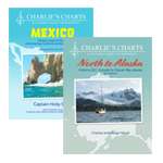
Charlie's Charts
Cruising Guide Publications
Evergreen Publishing
Imray Guides
Jimmy Cornell Books
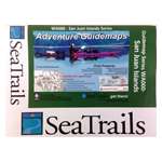
Sea Trail Maps
Seaworthy Publications
Waterway Guides
Yachtsman Chart Books
International Chartbooks & Cruising Guides
U.S. Region Cruising Guides
Sort by Bestselling
Newest Items First
Sort Alphabetically: A to Z
Sort Alphabetically: Z to A
Sort by Price: Low to High
Sort by Price: High to Low
24 Per Page
16 Per Page
32 Per Page
64 Per Page
128 Per Page
Waterway Guide Great Lakes V2 Western 2022
$
54.99
Reference Map of Oceania, 2nd edition
$
9.95
Ionian 10th Edition
$
69.95
PUB. 154 Sailing Directions Enroute: British Columbia (CURRENT EDITION)
$
29.95
Long Island Sound Chart Atlas (12 x 18 spiral-bound)
$
39.95
2024 Waterway Guide - Southern - Book
$
54.99
2024 Waterway Guide - Gulf Coast - Book
$
54.99
Exploring Puget Sound & British Columbia
$
79.99
Corsica and North Sardinia, 4th edition
$
92.95
Waterway Guide Great Lakes V1 Eastern 2022
$
54.99
Atlantic Islands: 7th Edition
$
104.95
2026 Waterway Guide - Chesapeake Bay - Book
$
54.99
Secret Anchorages of Brittany (Imray)
$
49.95
Cruising Bulgaria and Romania (Imray)
$
36.95
The Danube (Imray)
$
29.95
Channel Islands: Cherbourg Peninsula & North Brittany
$
99.95
Italian Waters Pilot, 10th edition
$
104.95
Mediterranean Spain: Gibraltar to the French Border
$
104.95
Inland Waterways of the Netherlands 2ND ED
$
59.95
Map of Inland Waterways of France
$
23.95
Puerto Rico/Virgin Islands Chart Atlas (12 x 18" Spiral-Bound)
$
32.95
LANDFALL LEGALESE: CARRIBEAN
$
24.95
Best Anchorages of the Inside Passage: British Columbia's South and Central Coast from the Gulf Islands to Fitz Hugh Sound
$
44.95
Gold Panning the Pacific Northwest: A Guide to the Area's Best Sites for Gold - Book
$
24.95
Previous Page
1
2
3
4
5
6
Next Page