Cart is empty
Cart is empty
View cart
Checkout
Account
View Previous Orders
Favorites
Sign in
Create an Account
Email
Password
Forgot password?
Create a new basic account
Sign in
Remember me
Cart is empty
Cart is empty
View cart
Checkout
Account
View Previous Orders
Favorites
Sign in
Create an Account
Email
Password
Forgot password?
Create a new basic account
Sign in
Remember me
Menu
NOAA Nautical Charts for U.S. Waters
8.5 x 11 BookletCharts
NOAA Atlantic Coast charts
NOAA Pacific Coast charts
NOAA Alaska Coast charts
NOAA Gulf Coast charts
NOAA Great Lakes charts
NOAA Training Charts
NOAA Custom Charts (NCC's)
Worldwide Nautical Charts
Canadian (CHS) Charts
NGA Charts: Region 1 - North America
NGA Charts: Region 2 - Central, South America
NGA Charts: Region 3 - UK, Western Europe
NGA Charts: Region 4 - Scandinavia, Northern Russia
NGA Charts: Region 5 - Western Africa, Mediterranean, Black Sea
NGA Charts: Region 6 - Eastern Africa, Southern & Western Asia
NGA Charts: Region 7 - South East Asia, Indonesia, New Guinea, Australia
NGA Charts: Region 8 - Pacific Islands
NGA Charts: Region 9 - Eastern Asia, South Eastern Russia, Philippines
NGA Charts: Miscellaneous
Nautical Publications
U.S. Chart No.1
USCG Navigation Rules Handbook
Nautical Almanac
U.S. Coast Pilot
USCG Light Lists
Tide and Tidal Current Tables
American Practical Navigator - Bowditch
Sight Reduction Tables
Code of Federal Regulations (CFR)
Atlas of Pilot Charts
NGA List of Lights
View more
→
Nautical Books
Chartbooks & Cruising Guides
Boating Skills & How-To
Boats
Other
Logbooks
Myerchin Rigging Knives
Professional
Mariner Training
Navigation Tools
Nautical Books
Chartbooks & Cruising Guides
Boating Skills & How-To
Boats
Other
Logbooks
Myerchin Rigging Knives
Sort by Bestselling
Newest Items First
Sort Alphabetically: A to Z
Sort Alphabetically: Z to A
Sort by Price: Low to High
Sort by Price: High to Low
16 Per Page
24 Per Page
32 Per Page
64 Per Page
128 Per Page
The Knot Tying Bible: Climbing, Camping, Sailing, Fishing, Everyday
$
29.95
Maneuver and Dock Your Sailboat Under Power: High Winds, Current, Tight Marina, Backing In? No Problems!
$
17.99
Radar Transfer Plotting Sheets
$
13.95
The Nautical Almanac 1981
$
29.95
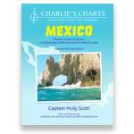
Charlie's Charts: COSTA RICA
$
34.95
Reeds Knot Handbook
$
16.00
Complete Book of Anchoring and Mooring, 2nd. edition
$
26.95
Jimmy Cornell 4-PACK (Includes Destinations, Routes, Planner & Sail the World with Me)
$
191.95
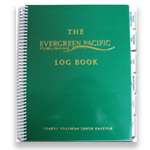
ENGINE ROOM LOG
$
14.95
River Cruising Atlas: Columbia, Snake, Willamette, 2014 Edition
$
59.99
Cruising Guide to the Southern Leeward Islands 2018-2019 Edition
$
34.95
Yachtsman Northwest Chart Book, 3rd edition
$
39.95
All 5 Pardey Videos (DVD Set)
$
99.95
Sextant: A Young Man's Daring Sea Voyage and the Men Who Mapped the World's Oceans
$
16.99
Charlie's Charts: HAWAIIAN ISLANDS
$
34.95
Chesapeake Bay Chart Atlas (12x18 spiral-bound)
$
44.95
Previous Page
1
2
3
4
5
6
7
8
9
10
11
12
13
Next Page
7 - 21