Cart is empty
Cart is empty
View cart
Checkout
Account
View Previous Orders
Favorites
Sign in
Create an Account
Email
Password
Forgot password?
Create a new basic account
Sign in
Remember me
Cart is empty
Cart is empty
View cart
Checkout
Account
View Previous Orders
Favorites
Sign in
Create an Account
Email
Password
Forgot password?
Create a new basic account
Sign in
Remember me
Menu
NOAA Nautical Charts for U.S. Waters
8.5 x 11 BookletCharts
NOAA Atlantic Coast charts
NOAA Pacific Coast charts
NOAA Alaska Coast charts
NOAA Gulf Coast charts
NOAA Great Lakes charts
NOAA Training Charts
NOAA Custom Charts (NCC's)
Worldwide Nautical Charts
Canadian (CHS) Charts
NGA Charts: Region 1 - North America
NGA Charts: Region 2 - Central, South America
NGA Charts: Region 3 - UK, Western Europe
NGA Charts: Region 4 - Scandinavia, Northern Russia
NGA Charts: Region 5 - Western Africa, Mediterranean, Black Sea
NGA Charts: Region 6 - Eastern Africa, Southern & Western Asia
NGA Charts: Region 7 - South East Asia, Indonesia, New Guinea, Australia
NGA Charts: Region 8 - Pacific Islands
NGA Charts: Region 9 - Eastern Asia, South Eastern Russia, Philippines
NGA Charts: Miscellaneous
Nautical Publications
U.S. Chart No.1
USCG Navigation Rules Handbook
Nautical Almanac
U.S. Coast Pilot
USCG Light Lists
Tide and Tidal Current Tables
American Practical Navigator - Bowditch
Sight Reduction Tables
Code of Federal Regulations (CFR)
Atlas of Pilot Charts
NGA List of Lights
View more
→
Nautical Books
Chartbooks & Cruising Guides
Boating Skills & How-To
Boats
Other
Logbooks
Myerchin Rigging Knives
Professional
Mariner Training
Navigation Tools
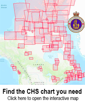
Use the CHS Chart Index
Displays the geographical extent of products produced by the
Canadian Hydrographic Service
,
Central and Arctic Region
Sort by Bestselling
Newest Items First
Sort Alphabetically: A to Z
Sort Alphabetically: Z to A
Sort by Price: Low to High
Sort by Price: High to Low
16 Per Page
24 Per Page
32 Per Page
64 Per Page
128 Per Page
CHS Chart 7065: Mill Island to Winter Island
$
24.95
CHS Chart 7066: Cape Dorchester to Spicer Islands
$
24.95
CHS Chart 7067: Spicer Islands to West Entrance of Fury and Hecla Strait
$
24.95
CHS Chart 7071: Cape Norton Shaw to Cape M'Clintock
$
24.95
CHS Chart 7072: Kane Basin to Lincoln Sea
$
24.95
CHS Chart 7103: Approaches to/Approches à Brevoort Harbour
$
24.95
CHS Chart 7121: Cape Mills to/à Cape Rammelsberg
$
24.95
CHS Chart 7122: Culbertson Island to/à Koojesse Inlet
$
24.95
CHS Chart 7125: Pike-Resor Channel
$
24.95
CHS Chart 7126: Culbertson Island to Frobisher's Farthest
$
24.95
CHS Chart 7127: Koojesse Inlet and Approaches/et les Approches
$
24.95
CHS Chart 7134: Robinson Bay and Approaches/et les Approches
$
24.95
CHS Chart 7135: Brevoort Harbour
$
24.95
CHS Chart 7136: Cape Mercy and Approaches/et les Approches
$
24.95
CHS Chart 7150: Pangnirtung
$
24.95
CHS Chart 7170: Exeter Bay and Approaches/et les Approches
$
24.95
5 - 19
Previous Page
13
14
15
16
17
18
19
20
21
22
23
24
25
26
Next Page