Cart is empty
Cart is empty
View cart
Checkout
Account
View Previous Orders
Favorites
Sign in
Create an Account
Email
Password
Forgot password?
Create a new basic account
Sign in
Remember me
Cart is empty
Cart is empty
View cart
Checkout
Account
View Previous Orders
Favorites
Sign in
Create an Account
Email
Password
Forgot password?
Create a new basic account
Sign in
Remember me
Menu
NOAA Nautical Charts for U.S. Waters
8.5 x 11 BookletCharts
NOAA Atlantic Coast charts
NOAA Pacific Coast charts
NOAA Alaska Coast charts
NOAA Gulf Coast charts
NOAA Great Lakes charts
NOAA Training Charts
NOAA Custom Charts (NCC's)
Worldwide Nautical Charts
Canadian (CHS) Charts
NGA Charts: Region 1 - North America
NGA Charts: Region 2 - Central, South America
NGA Charts: Region 3 - UK, Western Europe
NGA Charts: Region 4 - Scandinavia, Northern Russia
NGA Charts: Region 5 - Western Africa, Mediterranean, Black Sea
NGA Charts: Region 6 - Eastern Africa, Southern & Western Asia
NGA Charts: Region 7 - South East Asia, Indonesia, New Guinea, Australia
NGA Charts: Region 8 - Pacific Islands
NGA Charts: Region 9 - Eastern Asia, South Eastern Russia, Philippines
NGA Charts: Miscellaneous
Nautical Publications
U.S. Chart No.1
USCG Navigation Rules Handbook
Nautical Almanac
U.S. Coast Pilot
USCG Light Lists
Tide and Tidal Current Tables
American Practical Navigator - Bowditch
Sight Reduction Tables
Code of Federal Regulations (CFR)
Atlas of Pilot Charts
NGA List of Lights
View more
→
Nautical Books
Chartbooks & Cruising Guides
Boating Skills & How-To
Boats
Other
Logbooks
Myerchin Rigging Knives
Professional
Mariner Training
Navigation Tools
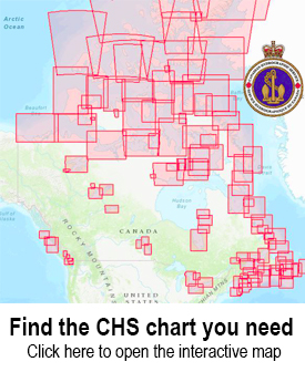
Use the CHS Chart Index
Displays the geographical extent of products produced by the
Canadian Hydrographic Service
,
Central and Arctic Region
Sort by Bestselling
Newest Items First
Sort Alphabetically: A to Z
Sort Alphabetically: Z to A
Sort by Price: Low to High
Sort by Price: High to Low
24 Per Page
16 Per Page
32 Per Page
64 Per Page
128 Per Page
CHS Chart 6201: Lake of the Woods / Lac des Bois
$
24.95
CHS Chart 6214: Sabaskong Bay
$
24.95
CHS Chart 6215: Basil Channel to/à Sturgeon Channel
$
24.95
Less 29%
CHS Chart 2204: Byng Inlet to/à Killarney
$
48.95
$
34.95
CHS Chart 2205: Killarney to/à Little Current
$
14.95
CHS Chart 6216: Sturgeon Channel to/à Big Narrows Island
$
24.95
CHS Chart 2207: Little Current to/à Clapperton Island
$
34.95
CHS Chart 2312: Nipigon Bay and Approaches/et les approches
$
24.95
CHS Chart 6105: Rainy Lake / Lac à la Pluie
$
24.95
CHS Chart 6211: Big Traverse Bay
$
24.95
CHS Chart 6213: Whitefish Bay
$
24.95
CHS Chart 7000: Arctic Archipelago / Archipel de l'Arctique
$
24.95
CHS Chart 2201: Georgian Bay / Baie Georgienne
$
24.95
CHS Chart 2301: Passage Island to/à Thunder Bay
$
24.95
CHS Chart 2029: Couchiching Lock to Port Severn / Écluse de Couchiching a Port Severn
$
22.95
CHS Chart 2042: Welland Canal St.Catharines to/à Port Colborne
$
24.95
CHS Chart 2085: Toronto Harbour
$
24.95
CHS Chart 2203: Carling Rock to/à Byng Inlet
$
48.95
CHS Chart 2274: Cape Hurd to/à Tobermory and/et Cove Island
$
24.95
CHS Chart 2292: Chantry Island to Cove Island
$
24.95
CHS Chart 6107: Hostess Island to/à Devils Cascade
$
24.95
CHS Chart 6287: Minaki to/à Kenora
$
24.95
CHS Chart 6370: Great Slave Lake / Grand lac des Esclaves, Western Portion / Partie ouest
$
24.95
CHS Chart 3853: Cape St. James to/à Cumshewa Inlet and/et Tasu Sound
$
24.95
Previous Page
1
2
3
4
5
6
7
8
Next Page
2 - 16