Cart is empty
Cart is empty
View cart
Checkout
Account
View Previous Orders
Favorites
Sign in
Create an Account
Email
Password
Forgot password?
Create a new basic account
Sign in
Remember me
Cart is empty
Cart is empty
View cart
Checkout
Account
View Previous Orders
Favorites
Sign in
Create an Account
Email
Password
Forgot password?
Create a new basic account
Sign in
Remember me
Menu
NOAA Nautical Charts for U.S. Waters
8.5 x 11 BookletCharts
NOAA Atlantic Coast charts
NOAA Pacific Coast charts
NOAA Alaska Coast charts
NOAA Gulf Coast charts
NOAA Great Lakes charts
NOAA Training Charts
NOAA Custom Charts (NCC's)
Worldwide Nautical Charts
Canadian (CHS) Charts
NGA Charts: Region 1 - North America
NGA Charts: Region 2 - Central, South America
NGA Charts: Region 3 - UK, Western Europe
NGA Charts: Region 4 - Scandinavia, Northern Russia
NGA Charts: Region 5 - Western Africa, Mediterranean, Black Sea
NGA Charts: Region 6 - Eastern Africa, Southern & Western Asia
NGA Charts: Region 7 - South East Asia, Indonesia, New Guinea, Australia
NGA Charts: Region 8 - Pacific Islands
NGA Charts: Region 9 - Eastern Asia, South Eastern Russia, Philippines
NGA Charts: Miscellaneous
Nautical Publications
U.S. Chart No.1
USCG Navigation Rules Handbook
Nautical Almanac
U.S. Coast Pilot
USCG Light Lists
Tide and Tidal Current Tables
American Practical Navigator - Bowditch
Sight Reduction Tables
Code of Federal Regulations (CFR)
Atlas of Pilot Charts
NGA List of Lights
View more
→
Nautical Books
Chartbooks & Cruising Guides
Boating Skills & How-To
Boats
Other
Logbooks
Myerchin Rigging Knives
Professional
Mariner Training
Navigation Tools
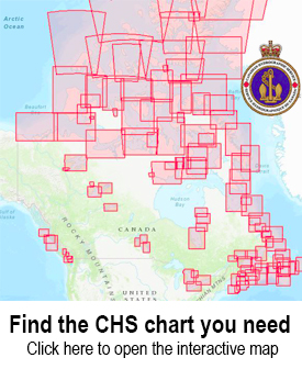
Use the CHS Chart Index
Displays the geographical extent of products produced by the
Canadian Hydrographic Service
,
Atlantic Region
Sort by Bestselling
Newest Items First
Sort Alphabetically: A to Z
Sort Alphabetically: Z to A
Sort by Price: Low to High
Sort by Price: High to Low
16 Per Page
24 Per Page
32 Per Page
64 Per Page
128 Per Page
CHS Chart 4583: St. Julien Island to/à Hooping Harbour including/y compris Canada Bay
$
24.95
CHS Chart 4584: White Bay - Southern Part / Partie Sud
$
18.95
CHS Chart 4585: Green Head to/à Little Bay Island
$
24.95
CHS Chart 4587: Mortier Bay
$
24.95
CHS Chart 4591: Pilley's Island Harbour-Halls Bay and/et Sunday Cove
$
24.95
CHS Chart 4592: Little Bay Island to/à League Rock
$
24.95
CHS Chart 4593: Sunday Cove Island to/à Thimble Tickles
$
24.95
CHS Chart 4615: Harbours in Placentia Bay Petite Forte to Broad Cove Head
$
24.95
CHS Chart 4616: Burin Harbours and Approches / et les approches
$
24.95
CHS Chart 4617: Red Island to/à Pinchgut Point
$
24.95
CHS Chart 4619: Presque Harbour to/à Bar Haven Island and/et Paradise Sound
$
24.95
CHS Chart 4622: Cape St. Mary's to/à Argentia Harbour and/et Jude Island
$
24.95
CHS Chart 4624: Long Island to/à St. Lawrence Harbours
$
24.95
CHS Chart 4625: Burin Peninsula to/à Saint-Pierre
$
24.95
CHS Chart 4626: Saint-Pierre and/et Miquelon (France)
$
24.95
CHS Chart 4638: Wreck Island to/à Cinq Cerf Bay
$
24.95
1 - 8
Previous Page
2
3
4
5
6
7
8
9
10
11
12
13
14
15
16
Next Page
10 - 18