Cart is empty
Cart is empty
View cart
Checkout
Account
View Previous Orders
Favorites
Sign in
Create an Account
Email
Password
Forgot password?
Create a new basic account
Sign in
Remember me
Cart is empty
Cart is empty
View cart
Checkout
Account
View Previous Orders
Favorites
Sign in
Create an Account
Email
Password
Forgot password?
Create a new basic account
Sign in
Remember me
Menu
NOAA Nautical Charts for U.S. Waters
8.5 x 11 BookletCharts
NOAA Atlantic Coast charts
NOAA Pacific Coast charts
NOAA Alaska Coast charts
NOAA Gulf Coast charts
NOAA Great Lakes charts
NOAA Training Charts
NOAA Custom Charts (NCC's)
Worldwide Nautical Charts
Canadian (CHS) Charts
NGA Charts: Region 1 - North America
NGA Charts: Region 2 - Central, South America
NGA Charts: Region 3 - UK, Western Europe
NGA Charts: Region 4 - Scandinavia, Northern Russia
NGA Charts: Region 5 - Western Africa, Mediterranean, Black Sea
NGA Charts: Region 6 - Eastern Africa, Southern & Western Asia
NGA Charts: Region 7 - South East Asia, Indonesia, New Guinea, Australia
NGA Charts: Region 8 - Pacific Islands
NGA Charts: Region 9 - Eastern Asia, South Eastern Russia, Philippines
NGA Charts: Miscellaneous
Nautical Publications
U.S. Chart No.1
USCG Navigation Rules Handbook
Nautical Almanac
U.S. Coast Pilot
USCG Light Lists
Tide and Tidal Current Tables
American Practical Navigator - Bowditch
Sight Reduction Tables
Code of Federal Regulations (CFR)
Atlas of Pilot Charts
NGA List of Lights
View more
→
Nautical Books
Chartbooks & Cruising Guides
Boating Skills & How-To
Boats
Other
Logbooks
Myerchin Rigging Knives
Professional
Mariner Training
Navigation Tools
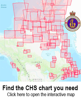
Use the CHS Chart Index
Displays the geographical extent of products produced by the
Canadian Hydrographic Service
,
Atlantic Region
Sort by Bestselling
Newest Items First
Sort Alphabetically: A to Z
Sort Alphabetically: Z to A
Sort by Price: Low to High
Sort by Price: High to Low
24 Per Page
16 Per Page
32 Per Page
64 Per Page
128 Per Page
CHS Chart 4639: Garia Bay and/et Le Moine Bay
$
18.95
CHS Chart 4640: Isle aux Morts and Approaches/et les approches
$
24.95
CHS Chart 4641: Port aux Basques and Approaches/et les Approches
$
24.95
CHS Chart 4642: Great St. Lawrence Harbour and/et Lamaline Harbour
$
24.95
CHS Chart 4643: Île Saint-Pierre (France)
$
24.95
CHS Chart 4644: Bay D'Espoir and/et Hermitage Bay
$
24.95
CHS Chart 4652: Humber Arm Meadows Point to/à Humber River
$
24.95
CHS Chart 4653: Bay of Islands
$
24.95
CHS Chart 4654: Lark Harbour and/et York Harbour (Bay of Islands)
$
24.95
CHS Chart 4659: Port au Port
$
24.95
CHS Chart 4661: Bear Head to/à Cow Head
$
24.95
CHS Chart 4663: Cow Head to/à Pointe Riche
$
24.95
CHS Chart 4665: St. Margaret Bay and Approaches/et les approches
$
24.95
CHS Chart 4666: St. Barbe Point to/à Old Férolle Harbour
$
24.95
CHS Chart 4667: Savage Cove to/à St. Barbe Bay
$
24.95
CHS Chart 4668: Anchorages / Mouillages in the / dans le Strait of Belle Isle / Détroit de Belle Isle
$
18.95
CHS Chart 4669: Red Bay
$
24.95
CHS Chart 4670: Forteau Bay
$
18.95
CHS Chart 4679: Hawkes Bay, Port Saunders, Back Arm
$
24.95
CHS Chart 4680: Hawkes Bay to/à Ste Geneviève Bay including/y compris St. John Bay
$
24.95
CHS Chart 4682: Larkin Point to/à Cape Anguille
$
24.95
CHS Chart 4700: Belle Isle to/à Resolution Island
$
24.95
CHS Chart 4702: Corbett Island to/à Ship Harbour Head
$
24.95
CHS Chart 4703: White Point to/à Corbet Island
$
24.95
Previous Page
1
2
3
4
5
6
7
8
9
10
11
12
Next Page